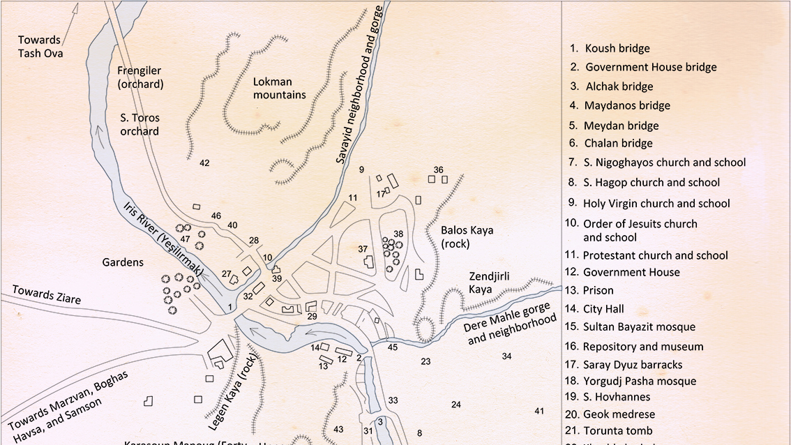
How to use this map

Click on the icon in the upper-left corner of the map. The map will be enlarged and display in full screen. Use the + and - signs on the left side of the map to zoom in or zoom out. Use the cursor to move across the map. Press the esc key to exit the full-screen mode.

A stone that was part of the structure of a home’s wellspring in Amasya, inscribed with “Give me water to drink, 1899.” It is currently on display in the Amasya Acheological Museum. Photographed by Lerna K. Yanık.
Sandjak of Amasya
The sandjak of Amasia during the Ottoman era.
Houshamadyan will publish a trove of material related to the life, history, and heritage of Armenians who lived in this historic region.
We also hope that natives of Amasya and their descendants, living all around the world, will contribute to this effort to revive their past by contributing digitized photographs, unpublished memoirs, artifacts to Houshamadyan.