Kaza of Lidje - Demography
Author: George Aghjayan, 14/07/2021 (Last modified: 14/07/2021)

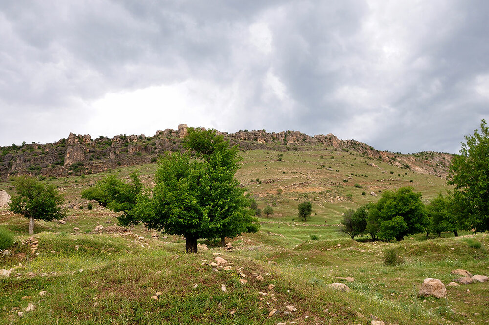
Nestled in the northeast corner of the Diyarbakir province, the Lije district bordered Palu and Jabaghchour. Early detailed population records for the district are lacking. In the mid-1800’s, the district contained over 200 villages and towns in the sub-districts of Lije, Pichar, Herta, Tavusi, Zikti, Gench, Yahkik and Hani. According to 1288 (1871-2) Ottoman yearbook for Diyarbakir, there were 21,478 men living in 7,128 households in the district with 84% Muslim and 16% non-Muslim. According to these statistics, the town of Hani was majority non-Muslim.
The years that followed, the geographic region included in Lije would change slightly and updated population figures indicated non-Muslims accounted for approximately 25% of the total population that ranged from 25-30,000 people. Government population records in the Ottoman Empire notoriously undercounted women and children. On the eve of the genocide, non-Muslim women were significantly more undercounted than Muslim women. Even accounting for this, massacre and emigration led to a decline in the proportion of non-Muslims to ~20%. The great majority of non-Muslims were Armenians with the remaining being Syrian Orthodox. On the eve of the genocide, it is estimated there were close to 6,000 Armenians living in the district.
The following details the information on the various villages in the Lije district where Armenians had lived prior to the genocide.
Lije [Lice]
38°27'59.62"N 40°38'46.44"E
2650 Armenians in 232 households
Sp. Asdvadzadzin church
The town of Lije was moved about a mile south to its current location after an earthquake in the 1970’s. I placed the location at the northern most part of the current town to reflect this move. Throughout the 1870’s, the provincial yearbooks for Diyarbakir stated the population of Lije to be 1634 Muslim males and 642 non-Muslim males in 942 total households. Fr. Karekin Srvantsdiants, around this same time, stated there were 200 Armenian households in the town of Lije. In 1882, these figures were updated to 6799 Muslim males and 2604 non-Muslim males in 3548 total households. Both populations had grown by more than four times the previous figures. On the eve of the genocide, there were 2650 Armenians in 232 households and 1980 Syrian Orthodox living in Lije.
Achkan, Ahtikan [Gönen]
38°30'50.51"N 40°42'24.61"E
12 households
Teotig is the only source listing Armenians as having lived in the village of Achkan. I could not find any mention of a village by this name in the district of Lije. Dr. Sarkis Karayan associated Achkan with Ahtikan with no further explanation. It is on this basis that I have supplied the coordinates. However, Teotig tends to order villages in a geographic progression. In this case, the progression follows Shadkhig, Antak, Achkan and Nounias. Excluding Achkan from this list, the villages follow a west to east progression in a natural order and proximity. There are two villages that would fill the geographic progression, Kokan [Pınarkuyu] and Lchok [Çavundur]. It could very well be that one of these two villages is what was referred to as Achkan in Teotig. Only Nishanian claims an Armenian population in any of these villages (Lchok). I can not determine definitively which village is Achkan at this time.
Antagh, Antak, Aintak [Kabakaya]
38°21'16.95"N 40°43'57.34"E
9 households
Sp. Sdepan
Srvantsdiants stated there were 7 Armenian households around 1880 while Teotig stated 9 households on the eve of the genocide.
Pamutin, Bametin, Bamitni, Baminti, Yamutni [Kutlu]
38°20'55.30"N 40°47'32.81"E
Srvantsdiants stated there were 2 Armenian households around 1880. Thereafter, Armenians were not recorded as living in Pamutin. Kevorkian misattributes Yamoutni with Palinjne.
(Source: Penyamin G. Jamgochian, Hayni: Deghakragan, Azkakragan, Badmakragran [Hayni: a Geographic, Ethnographic, and Historical Study], Beirut, 1951).
Halhal, Helhel [Çitlibahçe]
38°18'23.35"N 40°42'59.01"E
Sp. Kevork
Halhal had an Armenian population of 8 households around 1880 according to Srvantsdiants. It was listed among the Armenian inhabited villages on the eve of the genocide, but a specific population figure was not stated. Halhal is now part of the Hazro district.
Harpakhna, Harbakne [Bakanlar]
38°24'1.70"N 40°50'1.02"E
30 households
Srvantsdiants stated there were 45 households in Harpakhna. On the eve of the genocide, this figure had reduced to 30 households. Harpakhna is now a hamlet of Cofitni [Dallıca].


Herak [Çıralı]
38°26'2.84"N 40°47'48.73"E
There was only one Armenian household in Herak according to Srvantsdiants. While listed in Kevorkian, there was no Armenian population supplied for the eve of the genocide. Herak is now a hamlet of Darakol [Kıyı].
Hezan, Hazan [Savat]
38°20'38.57"N 40°37'27.58"E
Similar to Herak, there was only one Armenian household recorded by Srvantsdiants and while listed by Kevorkian, no Armenian population on the eve of the genocide.
Hezmas, Hazmas, Hazman [Budak]
38°24'13.60"N 40°45'16.73"E
Srvantsdiants only listed one Armenian household in Hezmas. It was not listed among the villages on the eve of the genocide.
Kur, Gur, Tepe [Tepe]
38°23'11.09"N 40°44'14.95"E
15 households
Srvantsdiants stated there were 30 Armenian households in Kur. On the eve of the genocide, this had been reduced in half. Kur is now a hamlet of Hezmas [Budak].

(Source: Penyamin G. Jamgochian, Hayni: Deghakragan, Azkakragan, Badmakragran [Hayni: a Geographic, Ethnographic, and Historical Study], Beirut, 1951).

Koymah, Koyman, Koume, Koum [Koma]
38°23'47.71"N 40°31'9.61"E
35 households
1 church
It is unclear which of the numerous villages with similar names the Armenian inhabited Koymah refers to. Karayan tentatively places the location approximately 4 miles north of Lije where a hamlet known as Konshahkomlari existed. Just to the west of this location was another village known as Konjakh or Konchah of which this hamlet seems to have been associated. Again, the village listings in Teotig imply Koymah was south of Lije, not north. The progression follows Harpakhna, Kur, Koymah and Shamsham. There is a location named Kom in this vicinity that sometimes appears on maps. Koymah is the last location listed in Srvantsdiants, just after Sarta. There are additional locations in the vicinity of Sarta also named Kom and Koma. My representation is the last of these locations, but in truth a case can be made for any of them. Srvantsdiants stated there were 40 Armenian households and one church. On the eve of the genocide, Teotig indicated Koymah was a purely Armenian village of 35 households with a church in ruins.
Malakhdan, Molla [Yünlüce]
38°28'6.86"N 40°43'28.76"E
Sp. Shmavon
Karayan associates Malakhdan with Malkozan [Kenicermik]. This location is actually rather close to one of the locations for Kom south of Lije mentioned above. I am not sure where the reference to Kenicermik comes from as I do not see that name in use. However, Srvantsdiants indicates Molla [Yünlüce] as another name for Malakhdan and it is located east of Lice. In addition, the progression of villages listed in Srvantsdiants places the location of Malakhdan consistent with the location of Molla. As such, this is where I have placed the location of the village. Srvantsdiants stated there were 20 Armenian households with a church, Sp. Shmavon. The village was no longer listed with an Armenian population on the eve of the genocide.

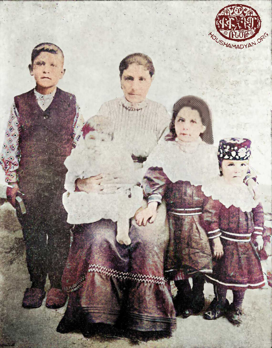
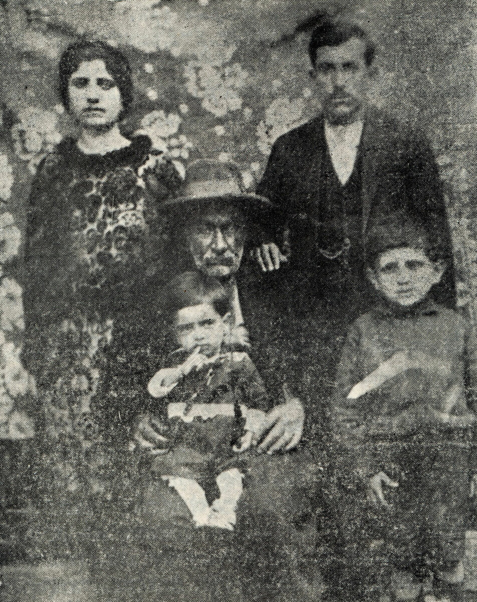
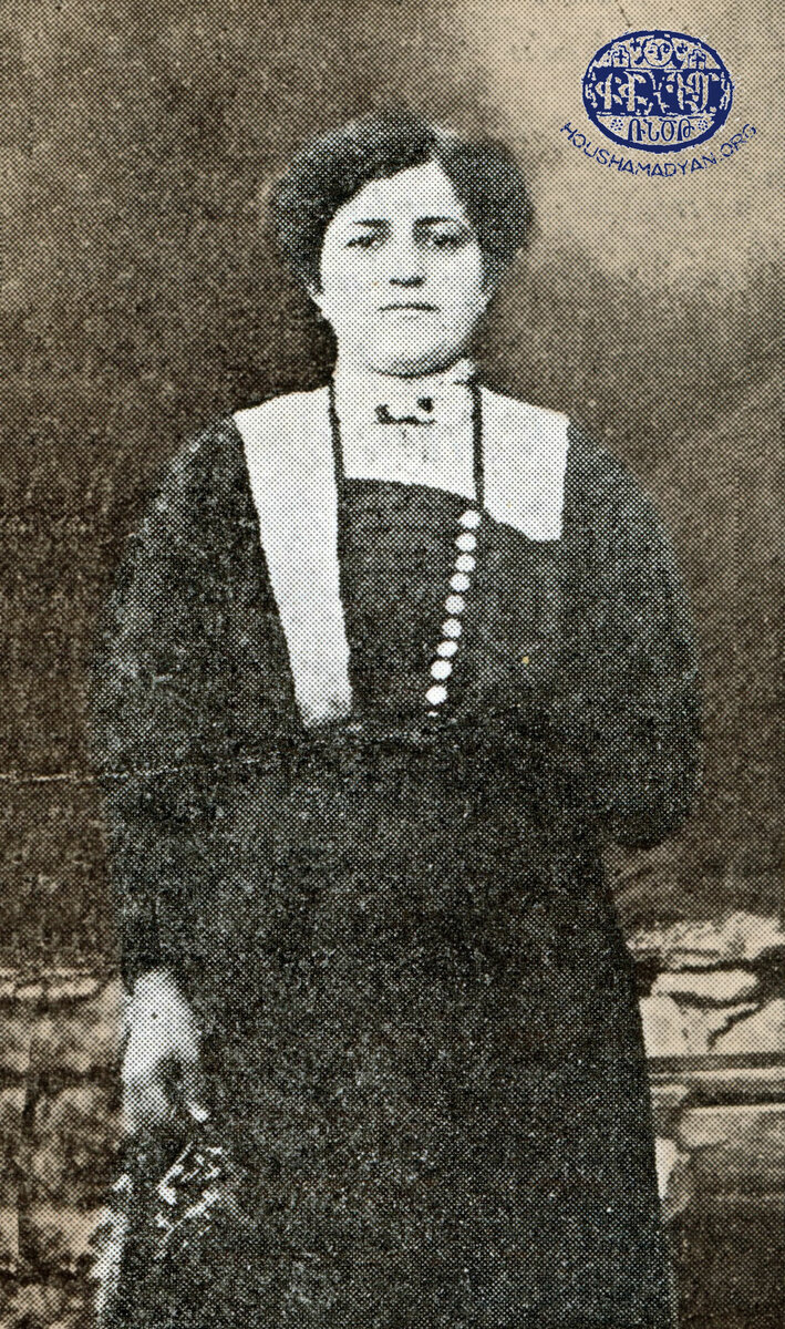
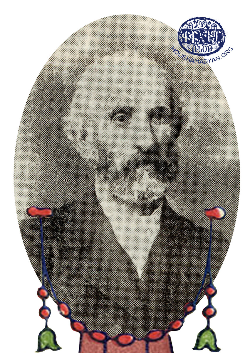
1) The Ghazarian/Demirdjian family. Standing, left to right: Toumig and her husband, Garabed. Seated, Arakel Mkhsi. The children are Arakel’s grandchildren. This photograph, originally in black and white, was digitally colorized using DeOldify and was retouched by Houshamadyan. Scroll to the end of the article for the original photograph (Source: Penyamin G. Jamgochian, Hayni: Deghakragan, Azkakragan, Badmakragran [Hayni: a Geographic, Ethnographic, and Historical Study], Beirut, 1951).
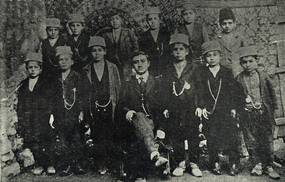
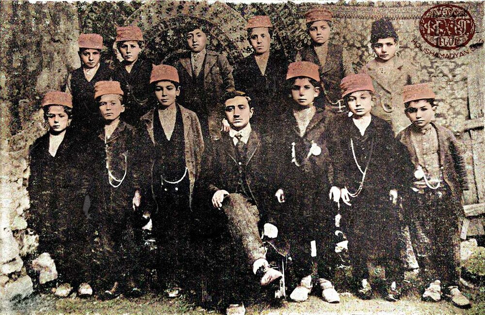
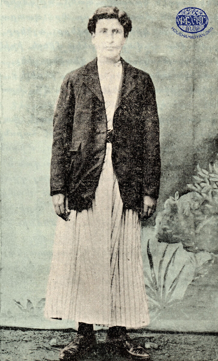
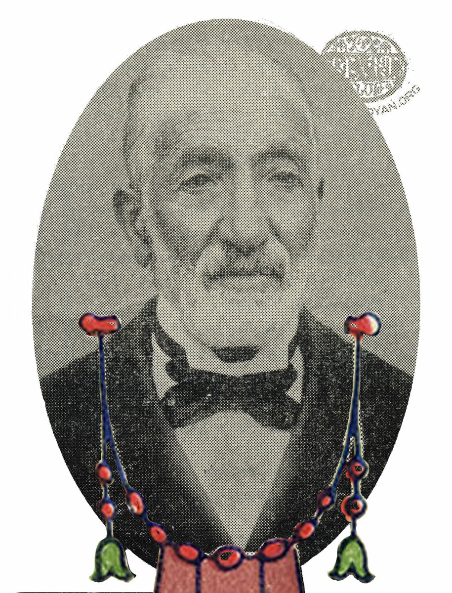
2) An Armenian family from Hayni. The seated woman is Hayganoush Basmadjian, the mother. The children, left to right, are Nshan, Shamiram, Varsenig, and Zabel. This photograph, originally in black and white, was digitally colorized using DeOldify and was retouched by Houshamadyan. Scroll to the end of the article for the original photograph (Source: Penyamin G. Jamgochian, Hayni: Deghakragan, Azkakragan, Badmakragran [Hayni: a Geographic, Ethnographic, and Historical Study], Beirut, 1951).
Nounyas, Nounias, Ninias [Ortaç]
38°20'16.74"N 40°39'20.26"E
7 households
1 church
Both Srvantsdiants and Teotig indicate Nounyas contained 7 Armenian households with one church.
Opoum, Hopoum, Ofoum, Fum [Kumluca]
38°27'42.69"N 40°39'50.88"E
80 households
Sp. Giragos
Opoum was just east of the town of Lije. Srvantsdiants indicated 90 Armenian households with a church, Sp. Giragos. On the eve of the genocide, Opoum still contained 80 Armenian households. Teotig stated the name of the church as Sp. Hagop instead of Sp. Giragos.
Sarnis, Sarnes [Damar]
38°27'6.87"N 40°41'46.60"E
30 households
Sp. Tovmas, Sp. Sarkis, Sp. Hagop. Sp. Toros, Sp. Shmavon
Srvantsdiants stated there were only 17 Armenian households in Sarnis, but that it contained 5 churches indicating historically the village would have been mush larger. On the eve of the genocide, Teotig stated Sarnis was an entirely Armenian village of 30 households with only Sp. Tovmas as a functioning church.

Sarta, Serde [Seren]
38°24'17.19"N 40°30'25.86"E
6 households
Both Srvantsdiants and Teotig indicate Sarta had a small Armenian population of 6 households.
Shadkhig, Shadhayk, Shathik [Çanak]
38°19'52.60"N 40°45'19.63"E
5 households
Srvantsdiants listed 10 Armenian households in Shadkhig. Teotig reduced this to 5 households on the eve of the genocide. Sahdkhig is now a hamlet of Antagh [Kabakaya].
Shamsham, Shemshan [Ormankaya]
38°17'43.63"N 40°46'5.36"E
40 households
Sp. Hovhannes
Srvantsdiants listed 44 Armenian households in Shamsham with one church, Sp. Hovhannes. There were still 40 Armenian households on the eve of the genocide with the church in ruins according to Teotig. Shamsham is now part of the Hazro district.
Shugaga, Shikakan, Shegaga [Şikakan]
38°24'51.89"N 40°46'12.27"E
Srvantsdiants only listed one Armenian household in Shugaga and it was simply listed as one of the Armenian inhabited villages with no population on the eve of the genocide. I have placed the location of the village near a cluster of buildings in proximity to the location shown on older maps.
Hayni, Heyne, Haini [Hani]
38°24'48.62"N 40°23'33.57"E
260 households
Sp. Asdvadzadzin
Throughout the 1870’s, the Diyarbakir provincial yearbook stated Hayni to be a majority Christian town (908 non-Muslim males to 818 Muslim males). However, the 1300 yearbook (1882-3) showed a marked increase in the Muslim male population to 4171 while the non-Muslim male population stayed almost the same at 984. Srvantsdiants listed 295 Armenian households with a church, Sp. Asdvadzadzin. On the eve of the genocide, Teotig indicated there were 260 Armenian households, 40 Syrian Orthodox households and 600 Muslim households.

(Source: Penyamin G. Jamgochian, Hayni: Deghakragan, Azkakragan, Badmakragran [Hayni: a Geographic, Ethnographic, and Historical Study], Beirut, 1951).
Barbesh, Birbas, Parpush [Çalıbükü]
38°27'5.39"N 40°33'48.63"E
Srvantsdiants only listed three Armenian household in Barbesh and it was simply listed as one of the Armenian inhabited villages with no population on the eve of the genocide. Karayan locates Barbesh in what is now the Kocaköy district (38°13'43.7"N 40°33'04.1"E), about 7 miles south of Palinchne. He refers to the location as Akçagöz, although I do not find that name in use anywhere else. Whereas Jelle Verheij states the location to be northeast of Hayni on the way toward Lije. Kevorkian also placed Barbesh in the location northeast of Hayni, which is the coordinates I refer to. In truth, a case could be made for either location.
Depne, Dibene, Debne, Dupne [Döğer]
38°21'23.81"N 40°13'27.72"E
Sp. Bedros-Boghos
Srvantsdiants stated there were 60 Armenian households and one church, Sp. Bedros-Boghos, in Depne. On the eve of the genocide, it was listed as one of the Armenian inhabited villages but without a specific population. Depne is now in the Dicle district.
Garas, Kervas, Garvas [Kocaköy]
38°20'32.66"N 40°40'50.64"E
Srvantsdiants stated there were 20 Armenian households in Garas. Kevorkian, citing Srvantsdiants, though, claims 30 Armenian households and a church, Sp. Sarkis. Garas is listed as one of the Armenian inhabited villages on the eve of the genocide, though without a specific population figure. Kevorkian uses the spellings Kervas and Garvas, but there was another village in the region of Lije by this name. Based on Kevorkian’s reference, Verheij has listed Kervas as having an Armenian population. Garas seems to always have been referred to by that name or slight variants of Karaz, Garaz, etc. and Kocaköy is the current name.
Havre, Havri [Yazıköy]
38°18'50.18"N 40°29'51.27"E
Srvantsdiants stated there were 7 households in Havre. After this, the village is not referenced with an Armenian population. Havre is now part of the Kocaköy district.
Joumayig, Zermanik [Okur]
38°22'40.05"N 40°22'42.06"E
Sp. Nshan
Srvantsdiants stated there were 11 Armenian households in Joumayig. On the eve of the genocide, it was listed as one of the Armenian inhabited villages but without a specific population.
Katin [Çaytepe]
38°12'38.10"N 40°30'25.64"E
20 households
Katin, which is now in the Kocaköy district, is only mentioned in Teotig within the Hayni district. On the eve of the genocide, it was stated to have an Armenian population of 20 households.
Kherchig, Khurchig, Horsik [Çaybaşı]
38°31'38.71"N 40°18'8.48"E
Srvantsdiants stated there were 3 households in Kherchig. After this, the village is not referenced with an Armenian population. Karayan has associated Kherchig with Horsik and these are the coordinates I have presented.
Palinchne [Esenler]
38°19'17.70"N 40°35'24.10"E
Srvantsdiants stated there were 10 Armenian households in Palinchne. On the eve of the genocide, it was listed as one of the Armenian inhabited villages but without a specific population. As stated previously, Kevorkian has confused this village with Pamutin. In addition, Karayan has placed the location of Palinchne just 1-2 miles southwest of the town of Hayni. I do not find his reference to Pelişna in any other source. I am showing the location of Palinchne as the current village of Esenler, southeast of Hayni. While many modern maps show this location as Balchik or Yalchik, pre-WW1 maps display the name as Balijni. Censuses of the Republic of Turkey between 1935 and 1960 list the village as Balichni as well and, thus, I believe this to be the location of Palinchne.
Zara [Gökçe]
38°20'39.36"N 40°31'18.43"E
Srvantsdiants stated there were 5 Armenian households in Zara. On the eve of the genocide, it was listed as one of the Armenian inhabited villages but without a specific population.
Pechar, Bechar, Peshar [Güldiken]
38°32'47.20"N 40°47'3.21"E
Sp. Asdvadzadzin
Srvantsdiants stated there were 12 Armenian households in Pechar with one church, Sp. Asdvadzadzin. On the eve of the genocide, it was listed as one of the Armenian inhabited villages but without a specific population.
Antou, Andou, Endir [Yorulmaz]
38°32'20.98"N 40°44'44.73"E
Sp. Hripsime
Srvantsdiants stated there were 8 Armenian households in Antou with one church, Sp. Hripsime. Thereafter, the village is not mentioned as having an Armenian population. Kevorkian did not specify a location for Antou. Karayan supplies coordinates that do not align with any specific village as far as I can determine. Verheij associated Antou with the village of Abdos which is now part of the Genj district of Bingol. The ordering of villages in Srvantsdiants is as follows: Yeghmoug, Antou, Mrzag, and Talanig. If we use this ordering as a guide, I believe the reference to Antou is the village referred to on maps as Endir and these are the coordinates I have used.
Herki, Herkin
38°39'7.83"N 40°47'14.20"E
Srvantsdiants stated there was only one Armenian household in Herki. On the eve of the genocide, it was listed as one of the Armenian inhabited villages but without a specific population. The coordinates for Herkin are approximate based on its depiction in a number of maps.

Morentar
Srvantsdiants stated there were 4 Armenian households in Morentar. Thereafter, the village is not mentioned and I was unable to determine its location.
Mrzag, Mizak [Kılıçli]
38°32'37.75"N 40°42'32.63"E
Sp. Giragos and one other church
Srvantsdiants stated there were 30 Armenian households in Mrzag with two churches, one named Sp. Giragos. On the eve of the genocide, it was listed as one of the Armenian inhabited villages but without a specific population.

Nor Shen, Nourshin [Nurşin]
38°37'58.42"N 40°47'30.39"E
Srvantsdiants stated there were 30 Armenian households in Nor Shen. On the eve of the genocide, it was listed as one of the Armenian inhabited villages but without a specific population. The coordinates for Nor Shen are approximate based on its depiction in a number of maps. Verheij lists a modern name of Doğanlar which is just to the West of the coordinates I have supplied.
Riz [Sağgöze]
38°36'51.16"N 40°48'22.07"E
3 churches
Srvantsdiants stated there were 60 Armenian households in Riz with 3 churches. On the eve of the genocide, it was listed as one of the Armenian inhabited villages but without a specific population.
Talanig, Dalanig [Kayadıbı]
38°30'32.53"N 40°46'29.98"E
Srvantsdiants stated there were 2 Armenian households in Talanig. Thereafter, the village is not mentioned.
Yeghmoug
38°36'17.71"N 40°44'49.54"E
Srvantsdiants stated there were 4 Armenian households in Talanig. Thereafter, the village is not mentioned. The coordinates for Yeghmoug are approximate based on its depiction in a number of maps.
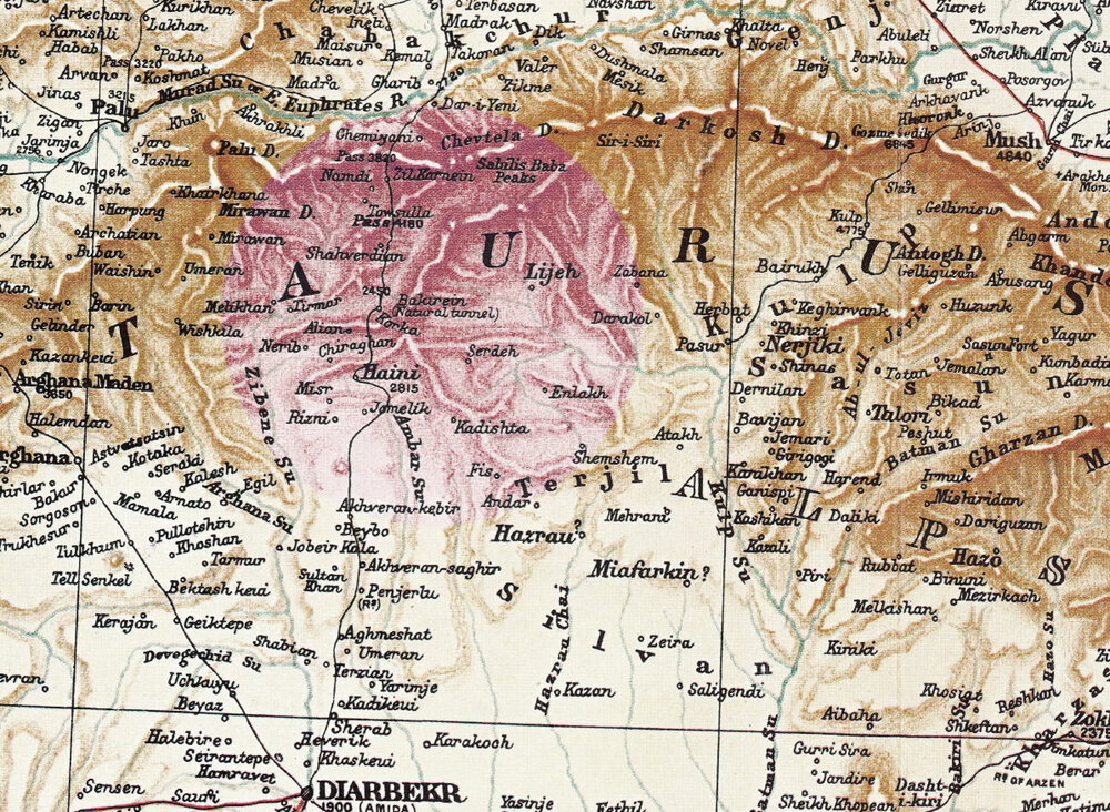
1) Detail from H. F. B. Lynch’s and F. Oswald’s Map of Armenia and Adjacent Countries, published in 1901, showing the area of Lidje and Hayni.
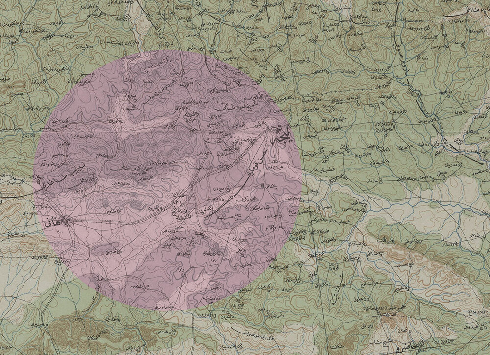
2) Detail from the 1912/1923 map of the Ottoman Empire, showing the area of Lidje and Hayni.
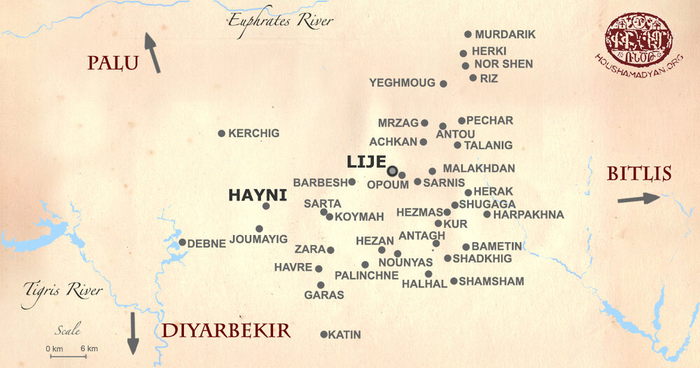
The current names of villages shown on the map are mentioned between brackets:
Achkan/Ahtikan [Gönen]; Antagh/Antak/Aintak [Kabakaya]; Antou/Andou [Yorulmaz]; Bametin/Bamitni/Pamutin [Kutlu]; Barbesh/Birbas/Parpush [Çalıbükü]; Depne/Dibene/Debne/Dupne [Döğer]; Halhal/Helhel [Çitlibahçe]; Harpakhna/Harbakne [Bakanlar]; Havre/Havri [Yazıköy]; Hayni/Heyne/Haini [Hani]; Herak [Çıralı]; Herki/Herkin [?]; Hezan/Hazan [Savat]; Hezmas/Hazmas/Hazman [Budak]; Joumayig/Zermanik [Okur]; Katin [Çaytepe]; Garas/Kervas[Kocaköy]; Kherchig/Khurchig/Horsik [Çaybaşı]; Koymah/Koume/Koum [Koma]; Kur/Gur/Tepe [Tepe]; Lije [Lice]; Malakhdan/Molla [Yünlüce]; Mrzag/Mizak [Kılıçli]; Murdarik/Mordarik [?]; Nor Shen/Nourshin [Nurşin];Nounyas/Nounias/Ninias [Ortaç]; Opoum/Hopoum/Ofoum [Kumluca]; Palinchne/Yamoutni/Pamotne [Esenler]; Pechar/Bechar/Peshar [Güldiken]; Riz [Sağgöze]; Sarnis/Sarnes [Damar]; Sarta/Serde [Seren]; Shadkhig/Shadhayk/Shathik [Çanak]; Shamsham/Shemshan [Ormankaya]; Shugaga/Shikakan/Shegaga [Şikakan]; Talanig/Dalanig [Kayadıbı]; Zara [Gökçe], Yeghmoud [?].
See also: https://westernarmenia.weebly.com/maps.html
Sources
- Germany. Generalstab der Luftwaffe, cartographer. Turkei 1:200,000. [Berlin, Germany] : Generalstab der Luftwaffe, 1943. Scale 1:200,000.
- Great Britain. War Office. General Staff. Geographical section. Turkey 1:200,000 London, 194-.
- İzgöer, Ahmet Z, Sıbğatullah Kaya, and Ali Kaya. Salname-i Diyarbekir. Diyarbakır: Diyarbakır Büyükşehir Belediyesi Yayınları, 1999.
- Karayan, Sarkis Y. Armenians in Ottoman Turkey, 1914: A Geographic and Demographic Gazetteer. 2018.
- Kévorkian Raymond H. “Demographic Changes in the Armenian Population of Diarbekir, 1895-1914.” In Armenian Tigranakert/Diarbekir and Edessa/Urfa, ed. R. Hovannisian. 2006.
- Kévorkian, Raymond H, and Paul B. Paboudjian. Les Arméniens Dans L'empire Ottoman À La Veille Du Génocide. Paris: Editions d'art et d'histoire, 1992.
- Kiepert, R. Karte Von Kleinasien. 1:400,000, 1902.
- Maunsell, F R. Eastern Turkey in Asia. Scale, 1: 250,000, or 1.014 Inches to 4 Miles. Compiled at the Intelligence Division, War Office, by Major F.r. Maunsell, Etc. London: Geographical Section, General Staff, 1901.
- Nişanyan, Sevan. Adını Unutan Ülke: Türkiye'de Adı Değiştirilen Yerler Sözlüğü. İstanbul: Everest Yayınları, 2010.
- Palu 1:200,000. Erkan-ı Harbiye-i Umumiyye. Istanbul, 1915.
- Srvantsdiants, Karekin (Fr). Թորոս Աղբար, Հայաստանի ճամբորդ [Toros Aghbar, a Traveler through Armenia], Vol. 2. 1884.
- Teotig, Գողգոթա հայ հոգեւորականութեան եւ իր հօտին աղէտալի 1915 տարին [The Calvary of the Armenian Clergy and its Followers in 1915]. 1985.
- Verheij, Jelle. “Provisional list of Non-Muslim Settlements in the Diyarbekir Vilayet around 1900.” In Social Relations in Ottoman Diyarbekir, 1870-1915, ed. J. Jongerden and J. Verheij. 2012.
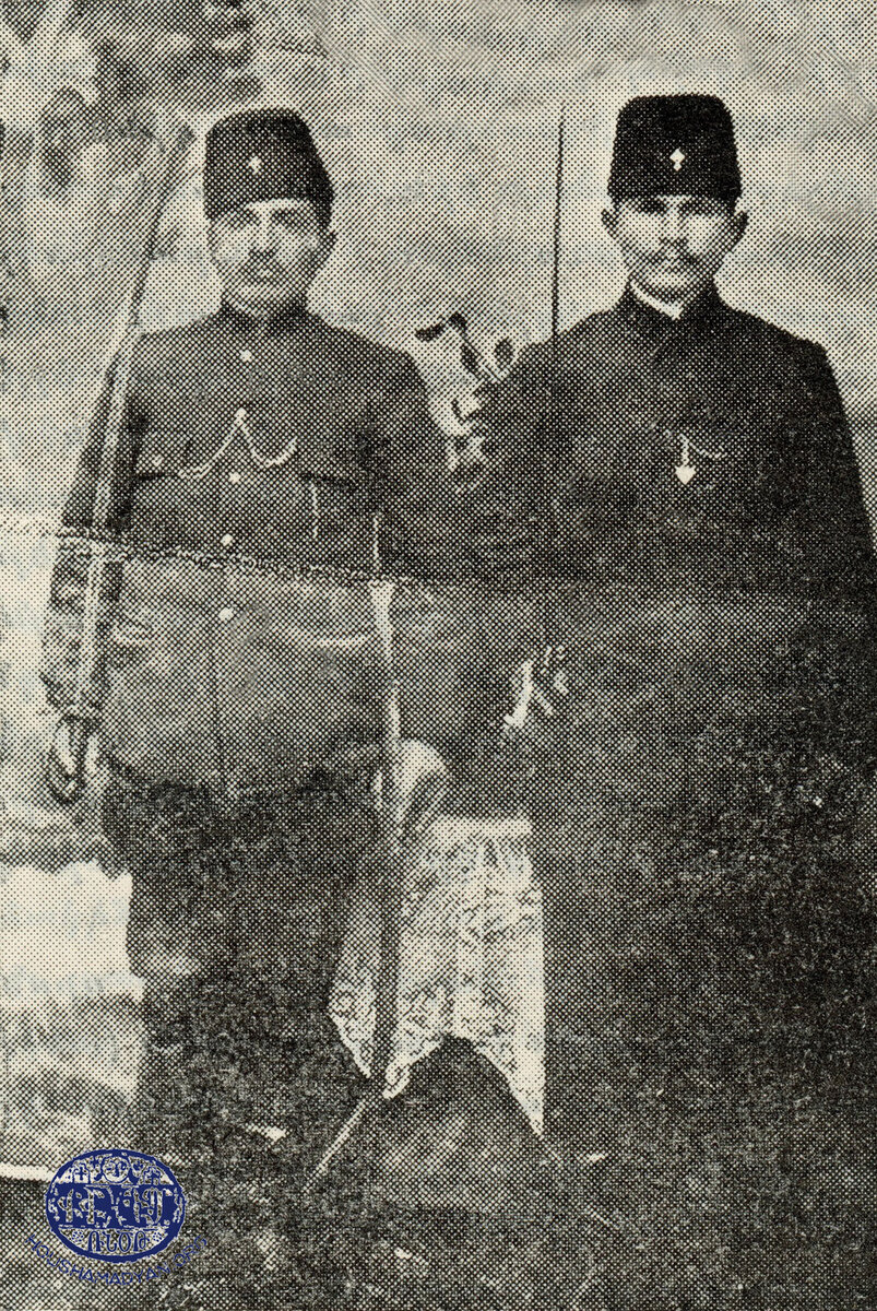
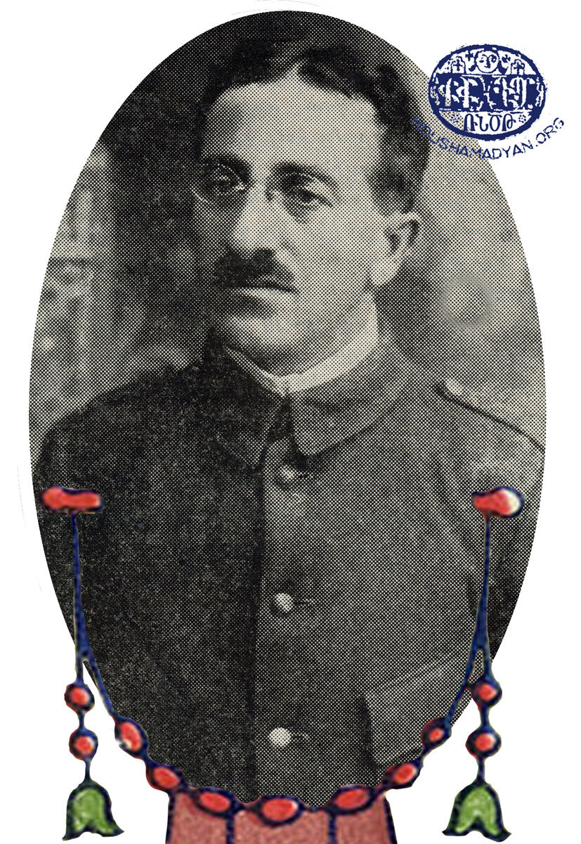
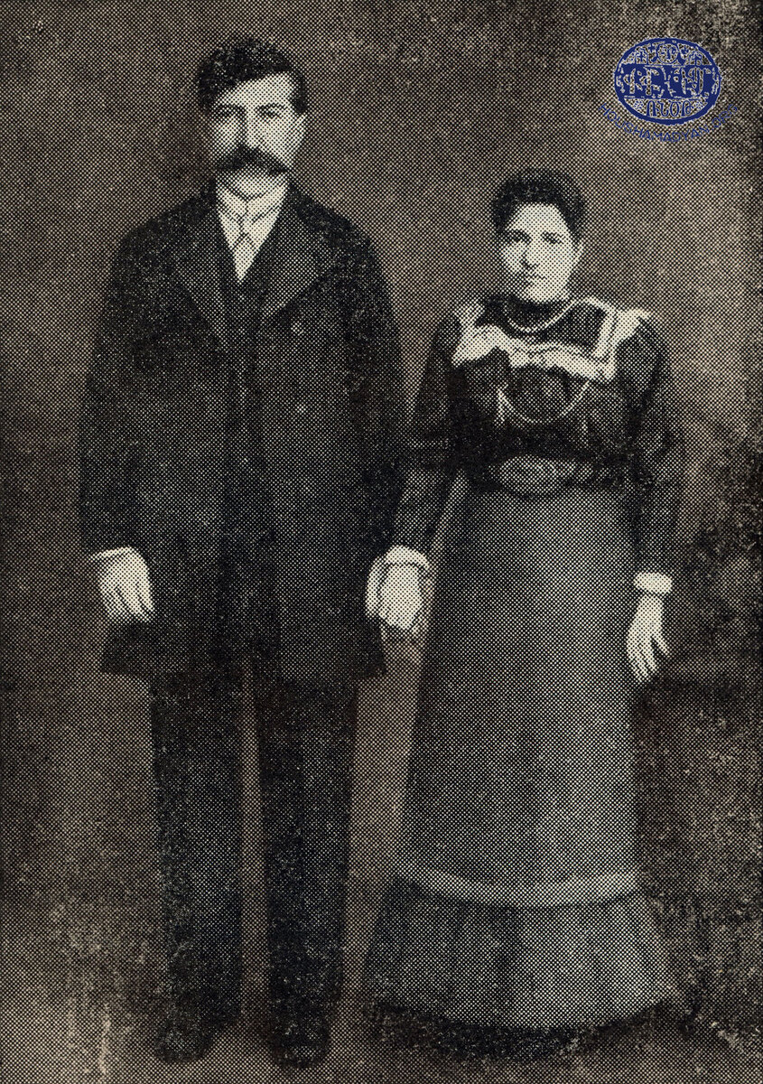
The original black-and-white versions of the above-mentioned photographs